


2022-07-06_19h54m02_28- hourquette d ancizan OK

ego
User
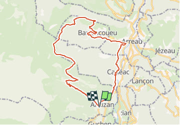

Length
19.4 km

Max alt
1577 m

Uphill gradient
1121 m
Km-Effort
34 km

Min alt
714 m

Downhill gradient
1128 m
Boucle
Yes
Creation date :
2022-07-06 17:54:02.638
Updated on :
2023-01-05 17:04:38.517
7h48
Difficulty : Very difficult

FREE GPS app for hiking
 SityTrail
IGN / Geographical institutes
SityTrail Plus
The world is yours!
About
Trail Walking of 19.4 km to be discovered at Occitania, Hautespyrenees, Ancizan. This trail is proposed by ego .
Positioning
Country:
France
Region :
Occitania
Department/Province :
Hautespyrenees
Municipality :
Ancizan
Location:
Unknown
Start:(Dec)
Start:(UTM)
282460 ; 4750043 (31T) N.
Comments