


lac de Belledonne

Liebeaux
User
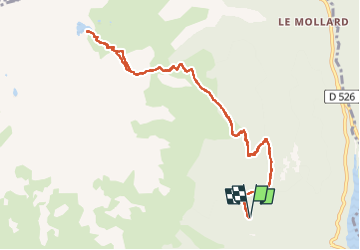

Length
11.9 km

Max alt
2178 m

Uphill gradient
932 m
Km-Effort
24 km

Min alt
1277 m

Downhill gradient
931 m
Boucle
Yes
Creation date :
2022-07-07 06:49:58.837
Updated on :
2022-07-07 13:41:43.569
6h51
Difficulty : Very difficult

FREE GPS app for hiking
 SityTrail
IGN / Geographical institutes
SityTrail Plus
The world is yours!
About
Trail Walking of 11.9 km to be discovered at Auvergne-Rhône-Alpes, Isère, Allemond. This trail is proposed by Liebeaux.
Positioning
Country:
France
Region :
Auvergne-Rhône-Alpes
Department/Province :
Isère
Municipality :
Allemond
Location:
Unknown
Start:(Dec)
Start:(UTM)
266349 ; 5003038 (32T) N.
Comments