


Pont de l’Abime

GioA10
User
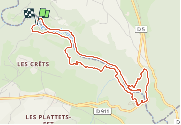

Length
6.2 km

Max alt
581 m

Uphill gradient
279 m
Km-Effort
9.9 km

Min alt
431 m

Downhill gradient
267 m
Boucle
Yes
Creation date :
2022-07-08 08:16:48.0
Updated on :
2022-07-08 10:14:35.373
1h57
Difficulty : Medium

FREE GPS app for hiking
 SityTrail
IGN / Geographical institutes
SityTrail Plus
The world is yours!
About
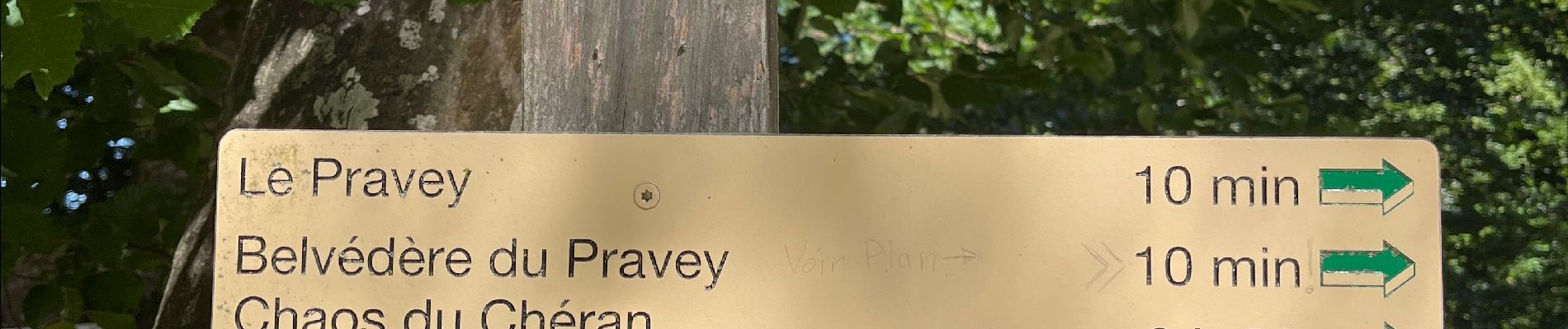
Trail Walking of 6.2 km to be discovered at Auvergne-Rhône-Alpes, Upper Savoy, Cusy. This trail is proposed by GioA10.
Photos


Positioning
Country:
France
Region :
Auvergne-Rhône-Alpes
Department/Province :
Upper Savoy
Municipality :
Cusy
Location:
Unknown
Start:(Dec)
Start:(UTM)
269744 ; 5073175 (32T) N.
Comments