


cure

Marc ROUSSELOT
User
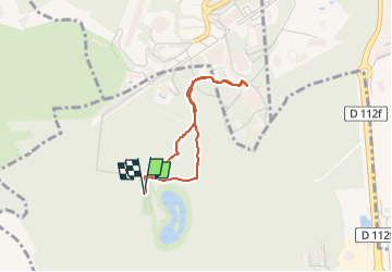

Length
2.6 km

Max alt
231 m

Uphill gradient
21 m
Km-Effort
2.9 km

Min alt
211 m

Downhill gradient
21 m
Boucle
Yes
Creation date :
2022-07-12 09:35:01.414
Updated on :
2022-07-12 10:09:49.452
33m
Difficulty : Easy

FREE GPS app for hiking
 SityTrail
IGN / Geographical institutes
SityTrail Plus
The world is yours!
About
Trail Walking of 2.6 km to be discovered at Grand Est, Moselle, Marange-Silvange. This trail is proposed by Marc ROUSSELOT.
Positioning
Country:
France
Region :
Grand Est
Department/Province :
Moselle
Municipality :
Marange-Silvange
Location:
Unknown
Start:(Dec)
Start:(UTM)
290869 ; 5457778 (32U) N.
Comments