


La Jonction

HG74250
User

Length
14.3 km

Max alt
2578 m

Uphill gradient
1537 m
Km-Effort
35 km

Min alt
1143 m

Downhill gradient
1529 m
Boucle
Yes
Creation date :
2022-07-12 11:49:34.472
Updated on :
2022-07-12 11:52:56.709
7h53
Difficulty : Very difficult

FREE GPS app for hiking
 SityTrail
IGN / Geographical institutes
SityTrail Plus
The world is yours!
About
Trail Walking of 14.3 km to be discovered at Auvergne-Rhône-Alpes, Upper Savoy, Chamonix-Mont-Blanc. This trail is proposed by HG74250.
Description
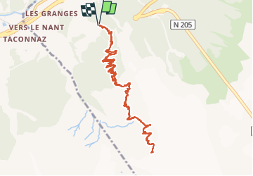
Montée à la Jonction, au départ du tremplin des Bossons (Chamonix).
Superbe vue sur les glaciers des Bossons et de Taconnaz.
Longue ascension, un peu rocheuse sur la fin.
Positioning
Country:
France
Region :
Auvergne-Rhône-Alpes
Department/Province :
Upper Savoy
Municipality :
Chamonix-Mont-Blanc
Location:
Unknown
Start:(Dec)
Start:(UTM)
332826 ; 5085076 (32T) N.
Comments