


RD-Plan-Les étangs

raymondfn
User
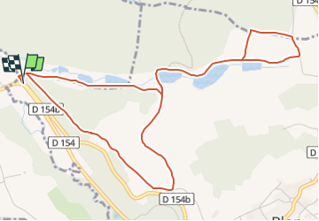

Length
6.6 km

Max alt
559 m

Uphill gradient
146 m
Km-Effort
8.6 km

Min alt
457 m

Downhill gradient
147 m
Boucle
Yes
Creation date :
2022-07-15 14:00:49.017
Updated on :
2022-07-15 14:08:28.944
1h58
Difficulty : Easy

FREE GPS app for hiking
 SityTrail
IGN / Geographical institutes
SityTrail Plus
The world is yours!
About
Trail On foot of 6.6 km to be discovered at Auvergne-Rhône-Alpes, Isère, Plan. This trail is proposed by raymondfn.
Positioning
Country:
France
Region :
Auvergne-Rhône-Alpes
Department/Province :
Isère
Municipality :
Plan
Location:
Unknown
Start:(Dec)
Start:(UTM)
685509 ; 5021475 (31T) N.
Comments