Trail Walking Cauterets - Rando Pont d'Espagne Lac de Gaube - Photo

Rando Pont d'Espagne Lac de Gaube

 Fab-Oz
Fab-Oz

User

© OpenStreetMap contributors
Length
Length
23 km
Max alt
Max alt
1751 m
Uphill gradient
Uphill gradient
1142 m
Km-Effort
Km-Effort  
39 km
Min alt
Min alt
1043 m
Downhill gradient
Downhill gradient
1141 m
Boucle
Boucle
Yes
Creation date :
2022-07-16 09:17:15.109
Updated on :
2022-07-16 18:03:16.96

(0 Reviews)

Walking
Walking
6h00
Difficulty : Difficult

Scan this QR Code to open this trail in the SityTrail application

FREE GPS app for hiking

Logo SityTrail SityTrail

IGN / Geographical institutes

Download SityTrail from the App Store Download SityTrail from Google Play

Logo SityTrail SityTrail Plus

The world is yours!

Download SityTrail from the App Store Download SityTrail from Google Play Download SityTrail on Huawei AppGallery

About

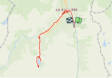
Trail Walking of 23 km to be discovered at Occitania, Hautespyrenees, Cauterets. This trail is proposed by Fab-Oz.

Description

Aller retour de la Fruitière jusqu'au lac de Gaube en passant par le Pont d'Espagne. 23km 1140D
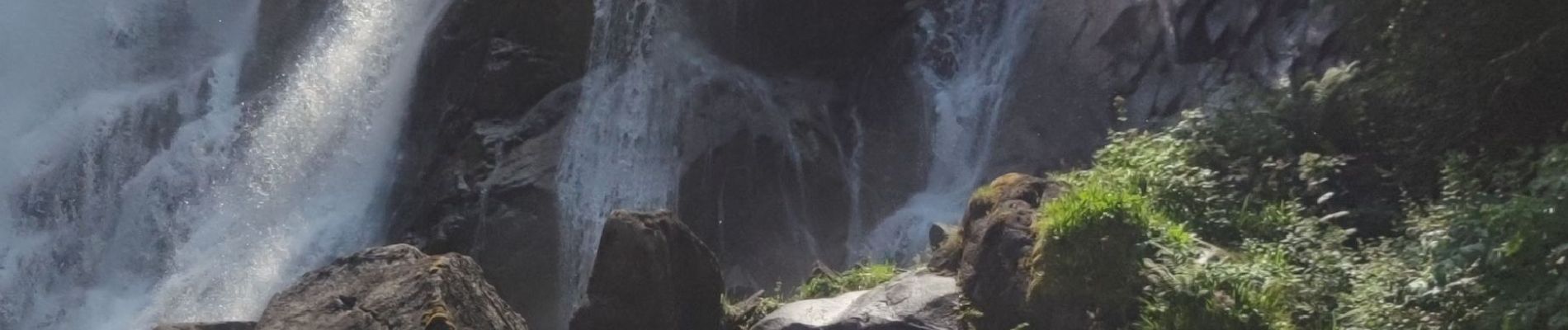
Au départ de la Fruitière, descendre le long du cours d'eau Lutour jusqu'à la belle cascade de Pisse-Arros, puis jusqu'à la Raillière.
Ensuite, on monte par le magnifique sentier des Cascades jusqu'au Pont d'Espagne, enfin on continue le sentier pour rejoindre le Lac de Gaube pour une baignade obligatoire (pour les courageux qui ne craignent pas l'eau froide)
Le retour se fait par le même chemin.

Elevation profile

Photos

Positioning

Country:
France
Region :
Occitania
Department/Province :
Hautespyrenees
Municipality :
Cauterets
Location:
Unknown
Start:(UTM)
736869 ; 4749221 (30T) N.


Close
My subscriptions