


Stage2

fpolini
User
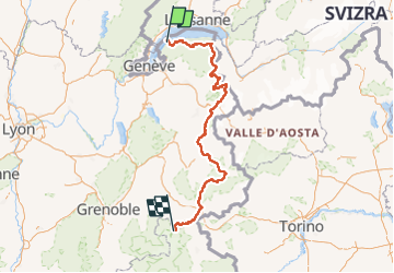

Length
380 km

Max alt
2832 m

Uphill gradient
22855 m
Km-Effort
679 km

Min alt
370 m

Downhill gradient
21165 m
Boucle
No
Creation date :
2022-07-16 19:55:02.981
Updated on :
2022-07-17 13:43:46.007
154h23
Difficulty : Very difficult

FREE GPS app for hiking
 SityTrail
IGN / Geographical institutes
SityTrail Plus
The world is yours!
About
Trail Walking of 380 km to be discovered at Auvergne-Rhône-Alpes, Upper Savoy, Yvoire. This trail is proposed by fpolini.
Positioning
Country:
France
Region :
Auvergne-Rhône-Alpes
Department/Province :
Upper Savoy
Municipality :
Yvoire
Location:
Unknown
Start:(Dec)
Start:(UTM)
294173 ; 5138797 (32T) N.
Comments