


les faures

sdroneau
User
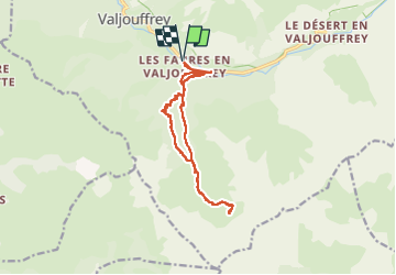

Length
14 km

Max alt
2046 m

Uphill gradient
1149 m
Km-Effort
29 km

Min alt
1050 m

Downhill gradient
1149 m
Boucle
Yes
Creation date :
2022-07-17 05:39:39.591
Updated on :
2022-07-17 12:25:58.712
5h48
Difficulty : Very difficult

FREE GPS app for hiking
 SityTrail
IGN / Geographical institutes
SityTrail Plus
The world is yours!
About
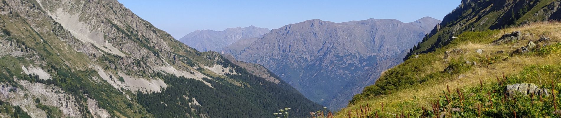
Trail Walking of 14 km to be discovered at Auvergne-Rhône-Alpes, Isère, Valjouffrey. This trail is proposed by sdroneau.
Photos

Positioning
Country:
France
Region :
Auvergne-Rhône-Alpes
Department/Province :
Isère
Municipality :
Valjouffrey
Location:
Unknown
Start:(Dec)
Start:(UTM)
266569 ; 4971874 (32T) N.
Comments