


Stage3

fpolini
User
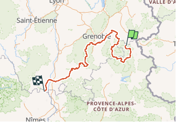

Length
535 km

Max alt
2838 m

Uphill gradient
29789 m
Km-Effort
939 km

Min alt
46 m

Downhill gradient
31797 m
Boucle
No
Creation date :
2022-07-17 13:40:19.234
Updated on :
2022-07-17 13:43:09.556
213h27
Difficulty : Very difficult

FREE GPS app for hiking
 SityTrail
IGN / Geographical institutes
SityTrail Plus
The world is yours!
About
Trail Walking of 535 km to be discovered at Provence-Alpes-Côte d'Azur, Hautes-Alpes, Le Monêtier-les-Bains. This trail is proposed by fpolini.
Positioning
Country:
France
Region :
Provence-Alpes-Côte d'Azur
Department/Province :
Hautes-Alpes
Municipality :
Le Monêtier-les-Bains
Location:
Unknown
Start:(Dec)
Start:(UTM)
295647 ; 4990188 (32T) N.
Comments