


Stage6

fpolini
User
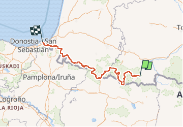

Length
442 km

Max alt
2744 m

Uphill gradient
24493 m
Km-Effort
771 km

Min alt
-1 m

Downhill gradient
25279 m
Boucle
No
Creation date :
2022-07-17 13:54:53.426
Updated on :
2022-07-17 13:57:09.479
175h11
Difficulty : Very difficult

FREE GPS app for hiking
 SityTrail
IGN / Geographical institutes
SityTrail Plus
The world is yours!
About
Trail Walking of 442 km to be discovered at Occitania, Hautespyrenees, Bourisp. This trail is proposed by fpolini.
Positioning
Country:
France
Region :
Occitania
Department/Province :
Hautespyrenees
Municipality :
Bourisp
Location:
Unknown
Start:(Dec)
Start:(UTM)
282153 ; 4745132 (31T) N.
Comments