


Stage1

fpolini
User
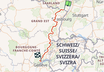

Length
672 km

Max alt
1671 m

Uphill gradient
24201 m
Km-Effort
994 km

Min alt
158 m

Downhill gradient
24013 m
Boucle
No
Creation date :
2022-07-17 14:07:42.501
Updated on :
2022-07-17 14:09:18.807
225h53
Difficulty : Very difficult

FREE GPS app for hiking
 SityTrail
IGN / Geographical institutes
SityTrail Plus
The world is yours!
About
Trail Walking of 672 km to be discovered at Rhineland-Palatinate, Landkreis Südliche Weinstraße, Schweigen-Rechtenbach. This trail is proposed by fpolini.
Positioning
Country:
Germany
Region :
Rhineland-Palatinate
Department/Province :
Landkreis Südliche Weinstraße
Municipality :
Schweigen-Rechtenbach
Location:
Unknown
Start:(Dec)
Start:(UTM)
423377 ; 5433184 (32U) N.
Comments