


lacs vert et bleu en boucle

chrisgps
User
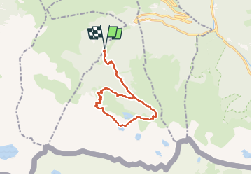

Length
15.2 km

Max alt
2372 m

Uphill gradient
1260 m
Km-Effort
32 km

Min alt
1126 m

Downhill gradient
1262 m
Boucle
Yes
Creation date :
2022-07-17 07:04:36.196
Updated on :
2022-07-18 12:40:34.192
9h17
Difficulty : Difficult

FREE GPS app for hiking
 SityTrail
IGN / Geographical institutes
SityTrail Plus
The world is yours!
About
Trail Walking of 15.2 km to be discovered at Occitania, Haute-Garonne, Castillon-de-Larboust. This trail is proposed by chrisgps.
Description
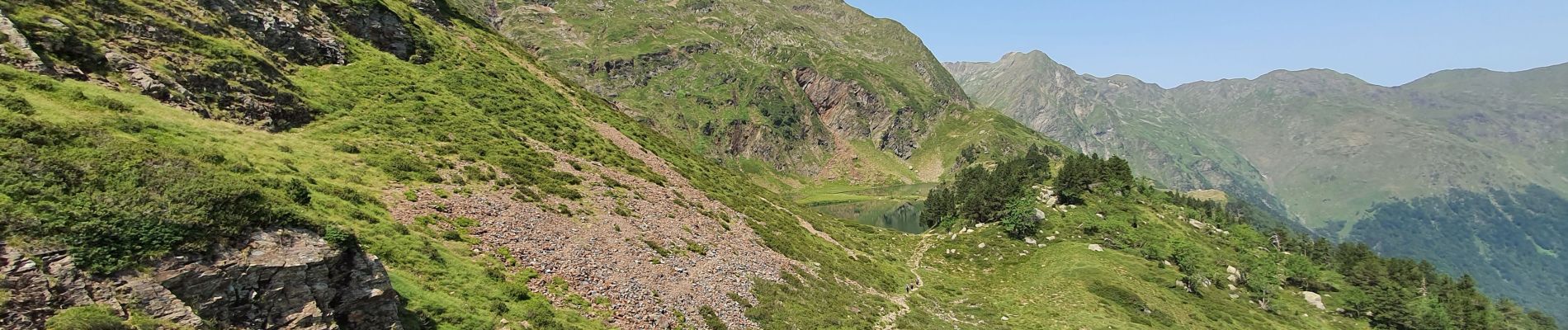
en montant par lac des Graouès
Photos


Positioning
Country:
France
Region :
Occitania
Department/Province :
Haute-Garonne
Municipality :
Castillon-de-Larboust
Location:
Unknown
Start:(Dec)
Start:(UTM)
299988 ; 4734622 (31T) N.
Comments