


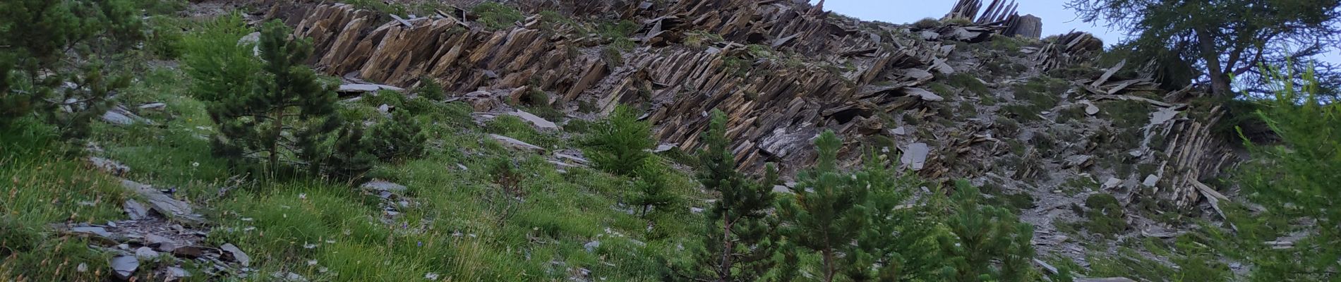
orgues de valsenestre

sdroneau
User
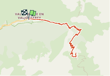

Length
13 km

Max alt
2372 m

Uphill gradient
1066 m
Km-Effort
27 km

Min alt
1300 m

Downhill gradient
1066 m
Boucle
Yes
Creation date :
2022-07-18 05:42:49.624
Updated on :
2022-07-18 12:08:48.149
6h07
Difficulty : Very difficult

FREE GPS app for hiking
 SityTrail
IGN / Geographical institutes
SityTrail Plus
The world is yours!
About
Trail Walking of 13 km to be discovered at Auvergne-Rhône-Alpes, Isère, Valjouffrey. This trail is proposed by sdroneau.
Photos

Positioning
Country:
France
Region :
Auvergne-Rhône-Alpes
Department/Province :
Isère
Municipality :
Valjouffrey
Location:
Unknown
Start:(Dec)
Start:(UTM)
267466 ; 4976889 (32T) N.
Comments