


Romontberg

Mangold
User
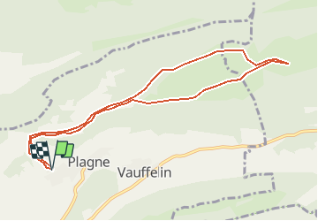

Length
9.6 km

Max alt
1116 m

Uphill gradient
240 m
Km-Effort
12.8 km

Min alt
903 m

Downhill gradient
241 m
Boucle
Yes
Creation date :
2014-12-10 00:00:00.0
Updated on :
2014-12-10 00:00:00.0
--
Difficulty : Unknown

FREE GPS app for hiking
 SityTrail
IGN / Geographical institutes
SityTrail Plus
The world is yours!
About
Trail Other activity of 9.6 km to be discovered at Bern, Bernese Jura administrative district, Sauge. This trail is proposed by Mangold.
Positioning
Country:
Switzerland
Region :
Bern
Department/Province :
Bernese Jura administrative district
Municipality :
Sauge
Location:
Plagne
Start:(Dec)
Start:(UTM)
369778 ; 5227455 (32T) N.
Comments