


st guiral

lablaquiere
User
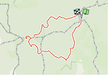

Length
9.9 km

Max alt
1340 m

Uphill gradient
233 m
Km-Effort
13 km

Min alt
1182 m

Downhill gradient
237 m
Boucle
Yes
Creation date :
2022-07-17 06:36:35.03
Updated on :
2022-07-19 16:26:27.433
2h16
Difficulty : Difficult

FREE GPS app for hiking
 SityTrail
IGN / Geographical institutes
SityTrail Plus
The world is yours!
About
Trail Walking of 9.9 km to be discovered at Occitania, Gard, Aumessas. This trail is proposed by lablaquiere.
Positioning
Country:
France
Region :
Occitania
Department/Province :
Gard
Municipality :
Aumessas
Location:
Unknown
Start:(Dec)
Start:(UTM)
538916 ; 4875397 (31T) N.
Comments