


Chaud Clapier 1

verozerr
User
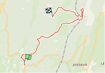

Length
7.9 km

Max alt
1562 m

Uphill gradient
371 m
Km-Effort
12.6 km

Min alt
1399 m

Downhill gradient
285 m
Boucle
No
Creation date :
2022-07-20 08:48:11.001
Updated on :
2022-07-20 21:52:17.194
3h36
Difficulty : Difficult

FREE GPS app for hiking
 SityTrail
IGN / Geographical institutes
SityTrail Plus
The world is yours!
About
Trail Walking of 7.9 km to be discovered at Auvergne-Rhône-Alpes, Drôme, Bouvante. This trail is proposed by verozerr.
Description
20072022
De chaud clapier à Serre Plume debut de la rando
Positioning
Country:
France
Region :
Auvergne-Rhône-Alpes
Department/Province :
Drôme
Municipality :
Bouvante
Location:
Unknown
Start:(Dec)
Start:(UTM)
684326 ; 4975223 (31T) N.
Comments