


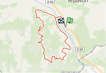

18.8 km | 24 km-effort


User


FREE GPS app for hiking
 SityTrail
IGN / Geographical institutes
SityTrail World
The world is yours!
Trail Walking of 5.5 km to be discovered at Auvergne-Rhône-Alpes, Drôme, Arpavon. This trail is proposed by Bruno Berlemont .
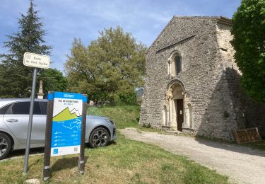
- Départ sur un parking le long de la D64. À une centaine de mètre vers la bifurcation en direction de ND Consolation (panneau).
✋ être attentif sur la route
- Ne pas entrer dans le champ de lavandes au retour. Rester sur la route...
- Possibilité de départ à partir du parking de la chapelle.
✋ Dans ce cas, la montée se fera en fin de parcours 😉


Road bike
Walking
Walking
Mountain bike

Walking
Walking

Walking
Walking
Walking