


foncouverte lac serpent nevache

marcagif
User
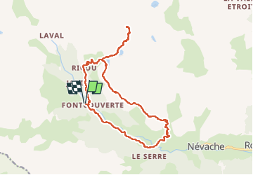

Length
18.8 km

Max alt
2692 m

Uphill gradient
1009 m
Km-Effort
32 km

Min alt
1744 m

Downhill gradient
1009 m
Boucle
Yes
Creation date :
2022-07-19 07:45:46.307
Updated on :
2022-07-21 10:55:50.75
5h31
Difficulty : Medium

FREE GPS app for hiking
 SityTrail
IGN / Geographical institutes
SityTrail Plus
The world is yours!
About
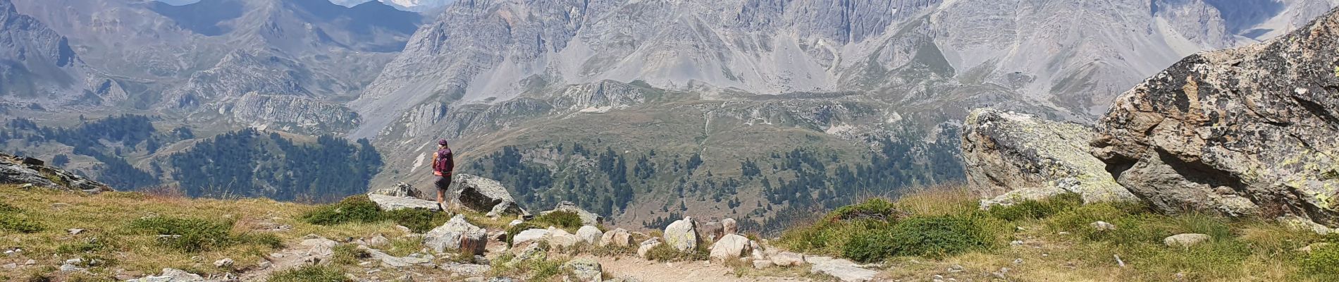
Trail Walking of 18.8 km to be discovered at Provence-Alpes-Côte d'Azur, Hautes-Alpes, Névache. This trail is proposed by marcagif.
Photos

Positioning
Country:
France
Region :
Provence-Alpes-Côte d'Azur
Department/Province :
Hautes-Alpes
Municipality :
Névache
Location:
Unknown
Start:(Dec)
Start:(UTM)
306621 ; 4989657 (32T) N.
Comments