


G4 certes Hautacam

LouisROGER
User GUIDE
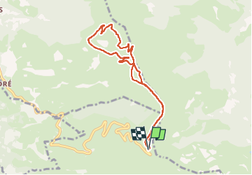

Length
8.3 km

Max alt
1686 m

Uphill gradient
177 m
Km-Effort
10.7 km

Min alt
1593 m

Downhill gradient
177 m
Boucle
Yes
Creation date :
2022-07-22 08:22:10.846
Updated on :
2022-07-22 12:36:52.043
3h45
Difficulty : Medium

FREE GPS app for hiking
 SityTrail
IGN / Geographical institutes
SityTrail Plus
The world is yours!
About
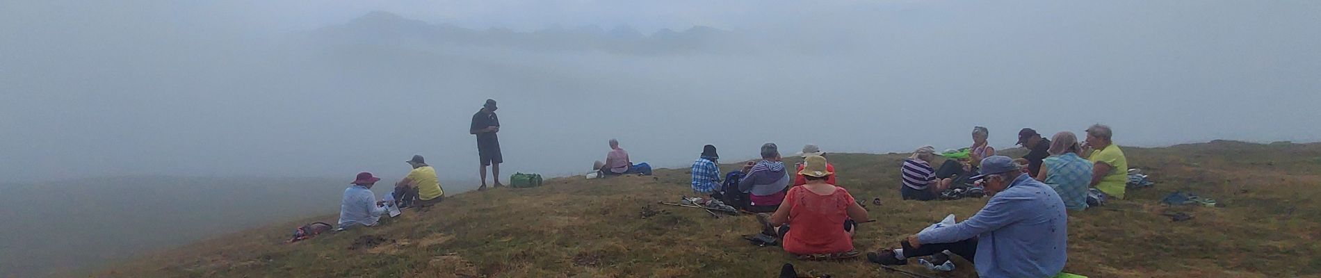
Trail Walking of 8.3 km to be discovered at Occitania, Hautespyrenees, Beaucens. This trail is proposed by LouisROGER.
Photos

Positioning
Country:
France
Region :
Occitania
Department/Province :
Hautespyrenees
Municipality :
Beaucens
Location:
Unknown
Start:(Dec)
Start:(UTM)
744345 ; 4762109 (30T) N.
Comments