


73 V2 REFUGE DRAYERES/TERRES ROUGES

trietsch
User
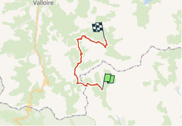

Length
16.2 km

Max alt
2551 m

Uphill gradient
798 m
Km-Effort
27 km

Min alt
2164 m

Downhill gradient
796 m
Boucle
No
Creation date :
2022-07-23 07:03:11.588
Updated on :
2022-07-23 07:04:52.752
6h05
Difficulty : Very difficult

FREE GPS app for hiking
 SityTrail
IGN / Geographical institutes
SityTrail Plus
The world is yours!
About
Trail Walking of 16.2 km to be discovered at Provence-Alpes-Côte d'Azur, Hautes-Alpes, Névache. This trail is proposed by trietsch.
Positioning
Country:
France
Region :
Provence-Alpes-Côte d'Azur
Department/Province :
Hautes-Alpes
Municipality :
Névache
Location:
Unknown
Start:(Dec)
Start:(UTM)
303978 ; 4994923 (32T) N.
Comments