


Sentire du Bocage B

Surfou
User

Length
2.7 km

Max alt
1060 m

Uphill gradient
37 m
Km-Effort
3.2 km

Min alt
1021 m

Downhill gradient
41 m
Boucle
Yes
Creation date :
2022-07-24 08:56:28.321
Updated on :
2022-07-24 08:56:28.321
43m
Difficulty : Easy

FREE GPS app for hiking
 SityTrail
IGN / Geographical institutes
SityTrail Plus
The world is yours!
About
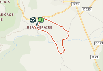
Trail Walking of 2.7 km to be discovered at Provence-Alpes-Côte d'Azur, Hautes-Alpes, Aubessagne. This trail is proposed by Surfou.
Positioning
Country:
France
Region :
Provence-Alpes-Côte d'Azur
Department/Province :
Hautes-Alpes
Municipality :
Aubessagne
Location:
Chauffayer
Start:(Dec)
Start:(UTM)
264286 ; 4958406 (32T) N.
Comments