


Baisse et lacs de Pral depuis la madone

katiab
User
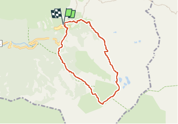

Length
7.6 km

Max alt
2333 m

Uphill gradient
555 m
Km-Effort
15 km

Min alt
1809 m

Downhill gradient
556 m
Boucle
Yes
Creation date :
2022-07-25 06:12:27.866
Updated on :
2022-07-25 10:57:38.806
3h32
Difficulty : Medium

FREE GPS app for hiking
 SityTrail
IGN / Geographical institutes
SityTrail Plus
The world is yours!
About
Trail Walking of 7.6 km to be discovered at Provence-Alpes-Côte d'Azur, Maritime Alps, Saint-Martin-Vésubie. This trail is proposed by katiab.
Positioning
Country:
France
Region :
Provence-Alpes-Côte d'Azur
Department/Province :
Maritime Alps
Municipality :
Saint-Martin-Vésubie
Location:
Unknown
Start:(Dec)
Start:(UTM)
368359 ; 4883760 (32T) N.
Comments