


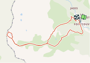
Col du Chardonnet - Lac de la Mine

jpb83
User

Length
11.7 km

Max alt
2642 m

Uphill gradient
791 m
Km-Effort
22 km

Min alt
1863 m

Downhill gradient
789 m
Boucle
Yes
Creation date :
2022-07-28 07:28:28.902
Updated on :
2022-07-28 07:30:13.09
5h03
Difficulty : Medium

FREE GPS app for hiking
 SityTrail
IGN / Geographical institutes
SityTrail Plus
The world is yours!
About
Trail Walking of 11.7 km to be discovered at Provence-Alpes-Côte d'Azur, Hautes-Alpes, Névache. This trail is proposed by jpb83.


Positioning
Country:
France
Region :
Provence-Alpes-Côte d'Azur
Department/Province :
Hautes-Alpes
Municipality :
Névache
Location:
Unknown
Start:(Dec)
Start:(UTM)
306645 ; 4989658 (32T) N.
Comments