


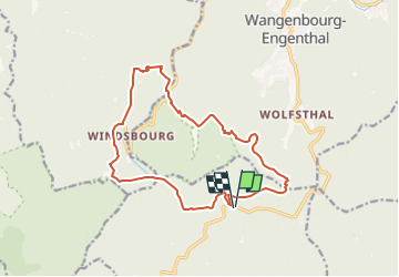
SityTrail - MF Nideck Schneeberg Wetzlach

vaillantjm
User

Length
15.2 km

Max alt
956 m

Uphill gradient
712 m
Km-Effort
25 km

Min alt
601 m

Downhill gradient
712 m
Boucle
Yes
Creation date :
2022-07-28 20:43:59.104
Updated on :
2022-07-28 20:56:51.411
5h30
Difficulty : Difficult

FREE GPS app for hiking
 SityTrail
IGN / Geographical institutes
SityTrail Plus
The world is yours!
About
Trail Walking of 15.2 km to be discovered at Grand Est, Bas-Rhin, Oberhaslach. This trail is proposed by vaillantjm.
Description
Variété de sentiers et chemins pour découvrir la forêt vosgienne dans toute sa profondeur. Une descente escarpée et rocailleuse peu arès le Scnneeberg.
Positioning
Country:
France
Region :
Grand Est
Department/Province :
Bas-Rhin
Municipality :
Oberhaslach
Location:
Unknown
Start:(Dec)
Start:(UTM)
373852 ; 5382874 (32U) N.
Comments