


Sortie marmottes - 28/07/22

michelelfn
User
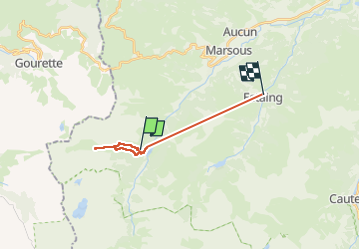

Length
14.8 km

Max alt
1919 m

Uphill gradient
1283 m
Km-Effort
33 km

Min alt
975 m

Downhill gradient
1623 m
Boucle
No
Creation date :
2022-07-28 09:14:02.0
Updated on :
2022-07-29 07:50:56.564
5h14
Difficulty : Easy

FREE GPS app for hiking
 SityTrail
IGN / Geographical institutes
SityTrail Plus
The world is yours!
About
Trail Walking of 14.8 km to be discovered at Occitania, Hautespyrenees, Arrens-Marsous. This trail is proposed by michelelfn.
Positioning
Country:
France
Region :
Occitania
Department/Province :
Hautespyrenees
Municipality :
Arrens-Marsous
Location:
Unknown
Start:(Dec)
Start:(UTM)
723496 ; 4754894 (30T) N.
Comments