


Lac de Barbat - 30/07/22

michelelfn
User
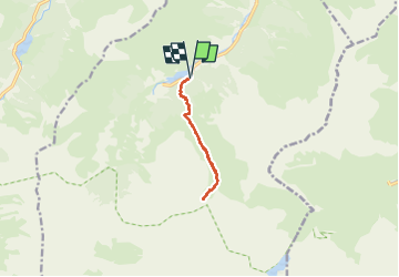

Length
9.4 km

Max alt
1981 m

Uphill gradient
809 m
Km-Effort
20 km

Min alt
1168 m

Downhill gradient
801 m
Boucle
Yes
Creation date :
2022-07-30 08:42:28.0
Updated on :
2022-07-30 15:01:21.319
4h57
Difficulty : Very difficult

FREE GPS app for hiking
 SityTrail
IGN / Geographical institutes
SityTrail Plus
The world is yours!
About
Trail Walking of 9.4 km to be discovered at Occitania, Hautespyrenees, Estaing. This trail is proposed by michelelfn.
Positioning
Country:
France
Region :
Occitania
Department/Province :
Hautespyrenees
Municipality :
Estaing
Location:
Unknown
Start:(Dec)
Start:(UTM)
728215 ; 4754257 (30T) N.
Comments