Trail Walking Longpont - en forêt de Retz_27_Longpont_Montgobert_Puiseux_AR - Photo

en forêt de Retz_27_Longpont_Montgobert_Puiseux_AR

forêts de France

© OpenStreetMap contributors
Length
Length
23 km
Max alt
Max alt
204 m
Uphill gradient
Uphill gradient
452 m
Km-Effort
Km-Effort  
29 km
Min alt
Min alt
80 m
Downhill gradient
Downhill gradient
452 m
Boucle
Boucle
Yes
Creation date :
2017-03-06 00:00:00.0
Updated on :
2020-11-08 11:08:30.146

(0 Reviews)

Walking
Walking
7h02
Difficulty : Very difficult

Scan this QR Code to open this trail in the SityTrail application

FREE GPS app for hiking

Logo SityTrail SityTrail

IGN / Geographical institutes

Download SityTrail from the App Store Download SityTrail from Google Play

Logo SityTrail SityTrail World

The world is yours!

Download SityTrail from the App Store Download SityTrail from Google Play Download SityTrail on Huawei AppGallery

About

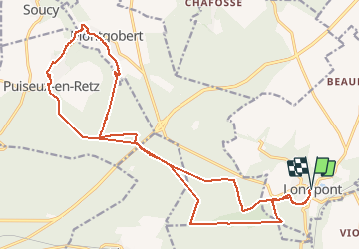
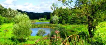
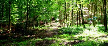
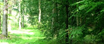
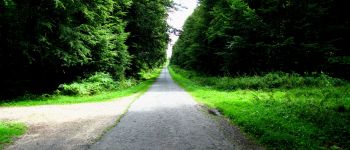
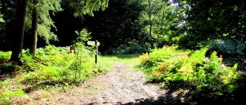
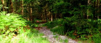
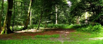
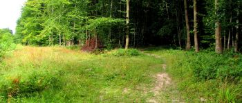
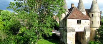
Trail Walking of 23 km to be discovered at Hauts-de-France, Aisne, Longpont. This trail is proposed by en forêt de Retz.

Description

voir aussi:
http://foret-de-retz.over-blog.com/

08/2014

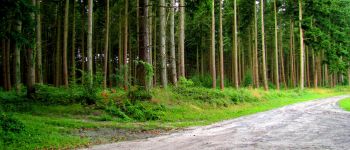
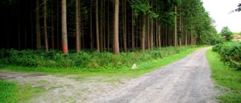
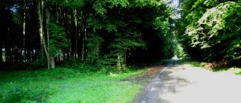
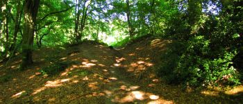
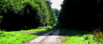
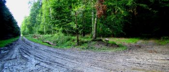
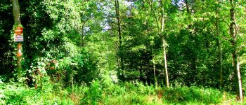
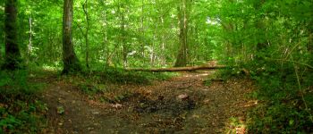
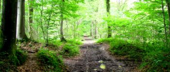
warning: certaines laies sont très difficiles à pratiquer car détrempées (laies éponges ou marécageuse). Même avec des chaussures montantes, step by step pour éviter d'avoir les pieds plein d'eau ou de boue(raison du classement très difficile)!
Une batterie pour iphone est indispensable pour le recharger si l'on veut enregistrer la rando avec sitytrail.

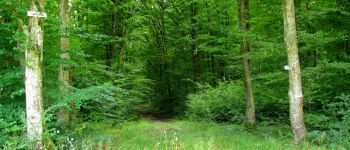
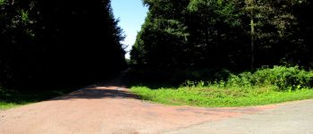
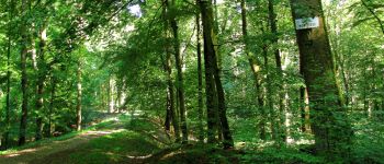
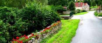
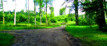
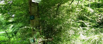
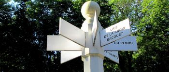
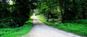
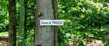
Au départ de l'abbaye de Longpont, rejoindre le GR11A aux trois maisons. Continuer jusqu'au vieux chemin de Longpont sur la gauche. Au carrefour Bosc, prendre à droite la laie des Grands Charmes jusqu'au carrefour des Ecuries puis à gauche la route de Chavigny jusqu'au carrefour de Chavigny. Prendre la laie des Monthieux, traverser le carrefour du Chapeau des Cordeliers et continuer jusqu'au pont de la N2. Le traverser puis tourner sur la droite pour rejoindre la route du Mur du Parc. La continuer jusqu'au carrefour du Lièvre. Prendre à droite la laie du Ravin (très difficile à partir du carrefour de la Culée, laie boueuse puis marécageuse) jusqu'à la route de la forêt à Montgobert. Rejoindre Puiseux par la D250 (impossible par le parcours de santé, propriété privée, interdit, tir à balles!).Traverser Puiseux puis prendre la route de Puiseux jusqu'au carrefour des six Routes. Prendre la route de Cabaret jusqu'au carrefour du Lièvre puis joindre le carrefour des têtes Salmon. Continuer jusqu'au carrefour de la Mare puis à celui des Carrosses. Traverser le pont de la N2, prendre la laie des Monthieux jusqu'au carrefour du Chapeau des Cordeliers. Prendre la laie de la Beauve jusqu'au carrefour des Sabots. Tourner à gauche sur la route de Chavigny et continuer jusqu'au carrefour de Chavigny. Prendre à droite la laie des Chamarts jusqu'au carrefour de la Croix Bacquet. Prendre le vieux chemin de Longpont puis la route du Pendu. Traverser le carrefour de Château-Fée puis continuer sur la route du Pendu jusqu'au carrefour du Pendu. Prendre à gauche la laie du vieux Mur et rejoindre le GR11A. Continuer pour rejoindre Longpont aux 3 maisons puis à l'abbaye.

Elevation profile

Points of interest

Point of interest Montgobert - Point 1 - Photo
JeanLucA4
MONTGOBERT 
Point of interest Montgobert - Point 2 - Photo
JeanLucA4
MONTGOBERT 
Point of interest Montgobert - Point 3 - Photo
JeanLucA4
MONTGOBERT 
Point of interest Montgobert - Point 4 - Photo
JeanLucA4
MONTGOBERT 
Point of interest Montgobert - Point 5 - Photo
JeanLucA4
MONTGOBERT 
Point of interest Montgobert - Point 6 - Photo
JeanLucA4
MONTGOBERT 
Point of interest Montgobert - Point 7 - Photo
JeanLucA4
MONTGOBERT 
Point of interest Fleury - Point 8 - Photo
JeanLucA4
FLEURY 
Point of interest Fleury - Point 9 - Photo
JeanLucA4
FLEURY 
Point of interest Fleury - Point 10 - Photo
JeanLucA4
FLEURY 
Point of interest Puiseux-en-Retz - Point 11 - Photo
JeanLucA4
PUISEUX-EN-RETZ 
Point of interest Puiseux-en-Retz - Point 12 - Photo
JeanLucA4
PUISEUX-EN-RETZ 
Point of interest Puiseux-en-Retz - Point 14 - Photo
JeanLucA4
PUISEUX-EN-RETZ 
Point of interest Puiseux-en-Retz - Point 15 - Photo
JeanLucA4
PUISEUX-EN-RETZ 
Point of interest Montgobert - Point 16 - Photo
JeanLucA4
MONTGOBERT 
Point of interest Montgobert - Point 18 - Photo
JeanLucA4
MONTGOBERT 
Point of interest Montgobert - Point 19 - Photo
JeanLucA4
MONTGOBERT 
Point of interest Puiseux-en-Retz - Point 20 - Photo
JeanLucA4
PUISEUX-EN-RETZ 
Point of interest Puiseux-en-Retz - Point 22 - Photo
JeanLucA4
PUISEUX-EN-RETZ 
Point of interest Puiseux-en-Retz - Point 23 - Photo
JeanLucA4
PUISEUX-EN-RETZ 
Point of interest Puiseux-en-Retz - Point 24 - Photo
JeanLucA4
PUISEUX-EN-RETZ 
Point of interest Fleury - Point 25 - Photo
JeanLucA4
FLEURY 
Point of interest Fleury - Point 26 - Photo
JeanLucA4
FLEURY 
Point of interest Montgobert - Point 27 - Photo
JeanLucA4
MONTGOBERT 
Point of interest Montgobert - Point 28 - Photo
JeanLucA4
MONTGOBERT 
Point of interest Montgobert - Point 29 - Photo
JeanLucA4
MONTGOBERT 
Point of interest Montgobert - Point 30 - Photo
JeanLucA4
MONTGOBERT 
Point of interest Montgobert - Point 31 - Photo
JeanLucA4
MONTGOBERT 
Point of interest Corcy - Point 32 - Photo
JeanLucA4
CORCY 
Point of interest Montgobert - Point 33 - Photo
JeanLucA4
MONTGOBERT 
Point of interest Montgobert - Point 34 - Photo
JeanLucA4
MONTGOBERT 
Point of interest Montgobert - Point 35 - Photo
JeanLucA4
MONTGOBERT 
Point of interest Longpont - Point 37 - Photo
JeanLucA4
LONGPONT 
Point of interest Longpont - Départ - Photo
JeanLucA4
LONGPONT 
Point of interest Longpont - Arrivée - Photo
JeanLucA4
LONGPONT 
Point of interest Puiseux-en-Retz - Point 13 - Photo
JeanLucA4
PUISEUX-EN-RETZ 
Point of interest Montgobert - Point 17 - Photo
JeanLucA4
MONTGOBERT 
Point of interest Puiseux-en-Retz - Point 21 - Photo
JeanLucA4
PUISEUX-EN-RETZ 
Point of interest Longpont - Point 36 - Photo
JeanLucA4
LONGPONT 

Positioning

Country:
France
Region :
Hauts-de-France
Department/Province :
Aisne
Municipality :
Longpont
Location:
Unknown
Start:(UTM)
515994 ; 5457850 (31U) N.

Trails nearby

Trail Walking Longpont - en forêt de Retz_19_Longpont_carrefour de Vauvaudran_AR - Photo
Walking

Walking

Medium
(1)
Longpont, Hauts-de-France, Aisne, France
17.5 km | 21 km-effort
4h 10min
Yes
Trail Walking Corcy - FLEURY .AISNE  - Photo
Walking
TURLUPIN2010

Walking

Medium
Corcy, Hauts-de-France, Aisne, France
5.7 km | 7.9 km-effort
1h 25min
Yes
Trail Walking Corcy - en forêt de Retz_91_04_2022_la Laie de la Belle Epine - Photo
Walking

Walking

Difficult
Corcy, Hauts-de-France, Aisne, France
10.6 km | 13.3 km-effort
3h 32min
Yes
Trail On foot Puiseux-en-Retz - Route du Faîte - Photo
On foot
PRO

On foot

Easy
Puiseux-en-Retz, Hauts-de-France, Aisne, France
5.8 km | 7.1 km-effort
1h 37min
No
Trail On foot Longpont - en forêt de Retz_22_Longpont_Rond d'Orléans_AR - Photo
On foot

On foot

Medium
Longpont, Hauts-de-France, Aisne, France
14.6 km | 17.5 km-effort
Unknown
Yes
Trail Walking Montgobert - en forêt de Retz_83_les Champs Mentard_le Fond d'Argent - Photo
Walking

Walking

Medium
Montgobert, Hauts-de-France, Aisne, France
13.6 km | 16.2 km-effort
3h 46min
Yes
Trail Walking Longpont - en forêt de Retz_77_Longpont_Puiseux en Retz_AR - Photo
Walking

Walking

Difficult
Longpont, Hauts-de-France, Aisne, France
22 km | 27 km-effort
6h 4min
Yes
Trail Walking Montgobert - en forêt de Retz_75_promenade familiale tout temps - Photo
Walking

Walking

Very easy
Montgobert, Hauts-de-France, Aisne, France
3.9 km | 4.7 km-effort
1h 25min
Yes
Trail Walking Longpont - en forêt de Retz_73_ballade (5) en toute saison - Photo
Walking

Walking

Easy
Longpont, Hauts-de-France, Aisne, France
9.1 km | 10.8 km-effort
2h 6min
Yes


Close
My subscriptions