


Montée au Puy de Dôme par le chemin des Muletiers

VacheKiri67
User
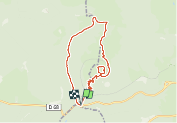

Length
8.2 km

Max alt
1462 m

Uphill gradient
434 m
Km-Effort
14 km

Min alt
1061 m

Downhill gradient
439 m
Boucle
Yes
Creation date :
2022-08-03 07:48:55.856
Updated on :
2022-08-07 14:14:48.016
4h29
Difficulty : Medium

FREE GPS app for hiking
 SityTrail
IGN / Geographical institutes
SityTrail Plus
The world is yours!
About
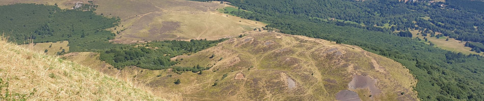
Trail Walking of 8.2 km to be discovered at Auvergne-Rhône-Alpes, Puy-de-Dôme, Orcines. This trail is proposed by VacheKiri67.
Description
Faite le 03/08/2022.
En partant du parking du Col de Ceyssat.
Retour par le chemin des Chèvres.
Photos


41 photos in total. Please click on a photo to see them all in the gallery.
Positioning
Country:
France
Region :
Auvergne-Rhône-Alpes
Department/Province :
Puy-de-Dôme
Municipality :
Orcines
Location:
Unknown
Start:(Dec)
Start:(UTM)
496652 ; 5067796 (31T) N.
Comments