


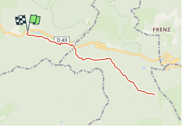
Parking, rue de Larcenaire - Les Prés de l'Etang - Col d'Oderen - Chemin des Alliés et Abri Forestier du Langenbach et retour

patrickbeyrath
User

Length
8.5 km

Max alt
926 m

Uphill gradient
231 m
Km-Effort
11.5 km

Min alt
823 m

Downhill gradient
230 m
Boucle
Yes
Creation date :
2022-08-04 18:39:49.0
Updated on :
2022-08-05 06:00:19.405
1h35
Difficulty : Medium

FREE GPS app for hiking
 SityTrail
IGN / Geographical institutes
SityTrail Plus
The world is yours!
About
Trail Walking of 8.5 km to be discovered at Grand Est, Vosges, Ventron. This trail is proposed by patrickbeyrath.
Positioning
Country:
France
Region :
Grand Est
Department/Province :
Vosges
Municipality :
Ventron
Location:
Unknown
Start:(Dec)
Start:(UTM)
343253 ; 5310235 (32T) N.
Comments