


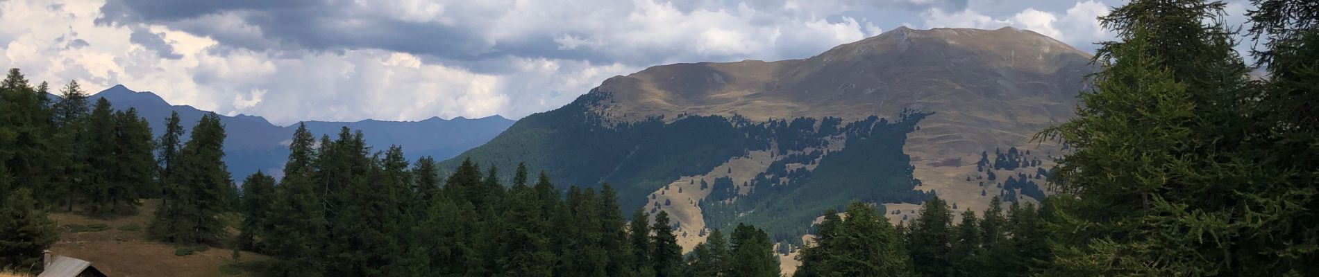
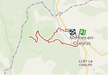
Col des Prés Fromage

edevuyst
User

Length
7.9 km

Max alt
2149 m

Uphill gradient
509 m
Km-Effort
14.7 km

Min alt
1671 m

Downhill gradient
515 m
Boucle
Yes
Creation date :
2022-08-05 09:57:19.0
Updated on :
2022-08-05 12:48:05.935
2h21
Difficulty : Medium

FREE GPS app for hiking
 SityTrail
IGN / Geographical institutes
SityTrail Plus
The world is yours!
About
Trail Walking of 7.9 km to be discovered at Provence-Alpes-Côte d'Azur, Hautes-Alpes, Molines-en-Queyras. This trail is proposed by edevuyst.
Photos


Positioning
Country:
France
Region :
Provence-Alpes-Côte d'Azur
Department/Province :
Hautes-Alpes
Municipality :
Molines-en-Queyras
Location:
Unknown
Start:(Dec)
Start:(UTM)
329178 ; 4955259 (32T) N.
Comments