


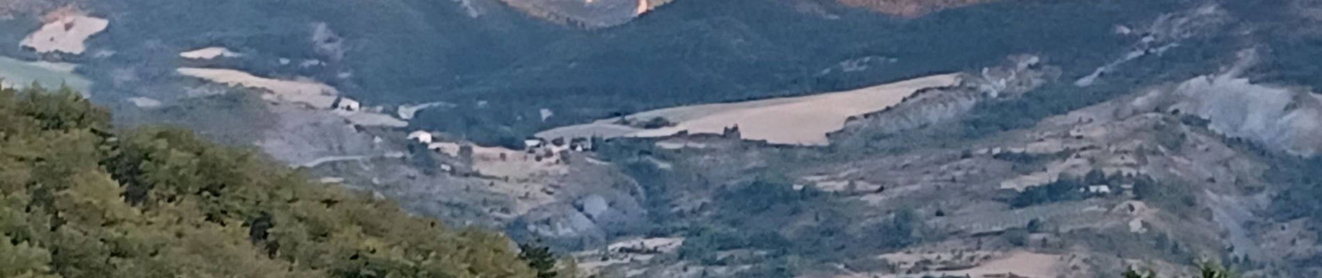
BEVONS crêtes de Chapage o l s m

RobinMicheline
User GUIDE
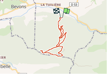

Length
8.2 km

Max alt
980 m

Uphill gradient
512 m
Km-Effort
15 km

Min alt
488 m

Downhill gradient
499 m
Boucle
Yes
Creation date :
2022-08-06 04:28:35.604
Updated on :
2022-08-06 09:57:05.983
2h37
Difficulty : Medium

FREE GPS app for hiking
 SityTrail
IGN / Geographical institutes
SityTrail Plus
The world is yours!
About
Trail Walking of 8.2 km to be discovered at Provence-Alpes-Côte d'Azur, Alpes-de-Haute-Provence, Sisteron. This trail is proposed by RobinMicheline.
Description
Cool
Photos


Positioning
Country:
France
Region :
Provence-Alpes-Côte d'Azur
Department/Province :
Alpes-de-Haute-Provence
Municipality :
Sisteron
Location:
Unknown
Start:(Dec)
Start:(UTM)
733180 ; 4894666 (31T) N.
Comments