


capvern G3 fait 2022

LouisROGER
User GUIDE
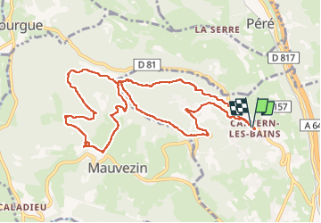

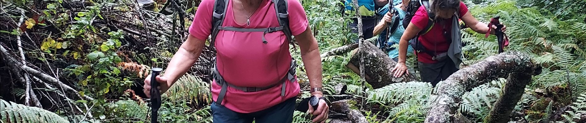
Length
12.1 km

Max alt
544 m

Uphill gradient
412 m
Km-Effort
17.6 km

Min alt
344 m

Downhill gradient
415 m
Boucle
Yes
Creation date :
2022-08-05 07:45:41.23
Updated on :
2022-08-06 08:00:02.442
5h40
Difficulty : Difficult

FREE GPS app for hiking
 SityTrail
IGN / Geographical institutes
SityTrail Plus
The world is yours!
About
Trail Walking of 12.1 km to be discovered at Occitania, Hautespyrenees, Capvern. This trail is proposed by LouisROGER.
Photos


Positioning
Country:
France
Region :
Occitania
Department/Province :
Hautespyrenees
Municipality :
Capvern
Location:
Unknown
Start:(Dec)
Start:(UTM)
281019 ; 4777783 (31T) N.
Comments