


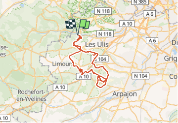
GIF JANVRY LA ROCHE TURPIN ROUSSIGNY GIF VTTAE 8 08 22

marcagif
User

Length
54 km

Max alt
178 m

Uphill gradient
727 m
Km-Effort
63 km

Min alt
84 m

Downhill gradient
727 m
Boucle
Yes
Creation date :
2022-08-07 07:37:11.837
Updated on :
2022-08-07 07:38:12.79
4h23
Difficulty : Very difficult

FREE GPS app for hiking
 SityTrail
IGN / Geographical institutes
SityTrail Plus
The world is yours!
About
Trail Mountain bike of 54 km to be discovered at Ile-de-France, Essonne, Gif-sur-Yvette. This trail is proposed by marcagif.
Positioning
Country:
France
Region :
Ile-de-France
Department/Province :
Essonne
Municipality :
Gif-sur-Yvette
Location:
Unknown
Start:(Dec)
Start:(UTM)
434978 ; 5394361 (31U) N.
Comments