


rochefort en terre

fbienmuller
User
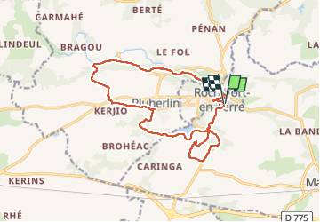

Length
16.4 km

Max alt
87 m

Uphill gradient
266 m
Km-Effort
19.9 km

Min alt
24 m

Downhill gradient
265 m
Boucle
Yes
Creation date :
2022-08-07 08:19:55.674
Updated on :
2022-08-07 13:30:11.54
4h34
Difficulty : Very easy

FREE GPS app for hiking
 SityTrail
IGN / Geographical institutes
SityTrail Plus
The world is yours!
About
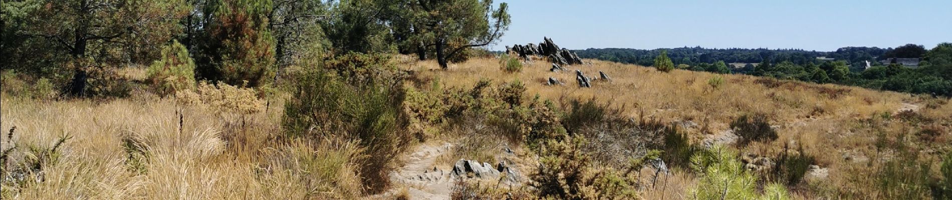
Trail Walking of 16.4 km to be discovered at Brittany, Morbihan, Malansac. This trail is proposed by fbienmuller.
Photos


Positioning
Country:
France
Region :
Brittany
Department/Province :
Morbihan
Municipality :
Malansac
Location:
Unknown
Start:(Dec)
Start:(UTM)
549808 ; 5282944 (30T) N.
Comments