


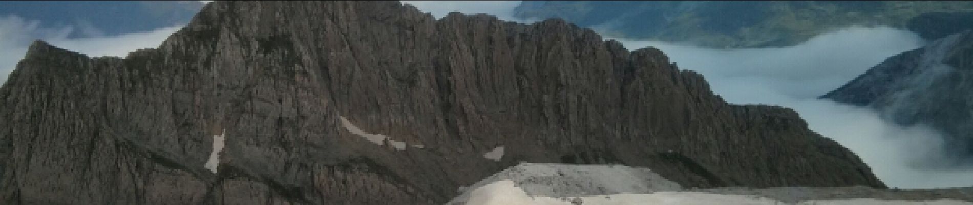
Breche de Rolland

reneperrin
User
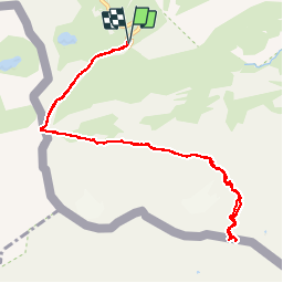

Length
12.1 km

Max alt
2854 m

Uphill gradient
719 m
Km-Effort
22 km

Min alt
2198 m

Downhill gradient
720 m
Boucle
Yes
Creation date :
2014-12-10 00:00:00.0
Updated on :
2014-12-10 00:00:00.0
4h34
Difficulty : Easy

FREE GPS app for hiking
 SityTrail
IGN / Geographical institutes
SityTrail Plus
The world is yours!
About
Trail Walking of 12.1 km to be discovered at Occitania, Hautespyrenees, Gavarnie-Gèdre. This trail is proposed by reneperrin.
Description
col des tentes jusqu'à la brèche de Rolland
Photos


Positioning
Country:
France
Region :
Occitania
Department/Province :
Hautespyrenees
Municipality :
Gavarnie-Gèdre
Location:
Gavarnie
Start:(Dec)
Start:(UTM)
741505 ; 4733251 (30T) N.
Comments
Hop dans ma liste des randos. Merci.
A faire absolument. Mais faire attention lors de la traversee de la cascade que vous aurez à faire. Le parcour de traversé fait un s dans la cascade. Le chemin le plus court n'est pas le bon . Mais à ce prix vous aurez droit à la brèche de Roland avec en prime une vue sur la source de la principale chute du cirque de Gavarnie et peut être un arc en ciel pour couronner le tout.
A faire absolument. Attention toutefois lors ndenlandescente