


Belledonne Lac Blanc refuge Jean Collet

c.gourme
User

Length
14.1 km

Max alt
2201 m

Uphill gradient
1010 m
Km-Effort
28 km

Min alt
1367 m

Downhill gradient
1011 m
Boucle
Yes
Creation date :
2022-08-03 06:01:29.0
Updated on :
2022-08-08 11:19:01.773
7h30
Difficulty : Medium

FREE GPS app for hiking
 SityTrail
IGN / Geographical institutes
SityTrail Plus
The world is yours!
About
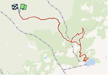
Trail Walking of 14.1 km to be discovered at Auvergne-Rhône-Alpes, Isère, Saint-Mury-Monteymond. This trail is proposed by c.gourme.
Positioning
Country:
France
Region :
Auvergne-Rhône-Alpes
Department/Province :
Isère
Municipality :
Saint-Mury-Monteymond
Location:
Unknown
Start:(Dec)
Start:(UTM)
730257 ; 5009178 (31T) N.
Comments