


Mechelse Heide à Maasmechelen - Les bruyères

Benjamin27
User GUIDE
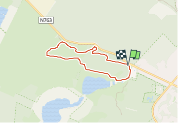


1h27
Difficulty : Medium

FREE GPS app for hiking
 SityTrail
IGN / Geographical institutes
SityTrail Plus
The world is yours!
About
Trail Walking of 5.5 km to be discovered at Flanders, Limburg, Maasmechelen. This trail is proposed by Benjamin27.
Description
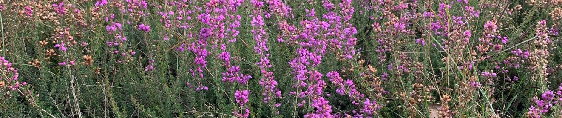
Champs infinis de bruyères dans un paysage désertique et typique de la Haute Campine.
👣 Distance : 5,6km - balisage hexagone jaune.
📍Départ : Toegangspoort Mechelse Heide, Joseph Smeetslaan 280 - 3630 Maasmechelen.
🚂🚍 Aller à la gare de Genk et prendre le bus DE LIJN 9 jusqu’à l’arrêt « Maasmechelen - Mechelse Heide ».
Photos

Positioning
Comments