


Gavarnie

sereton
User
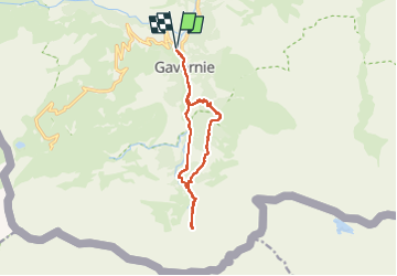

Length
13 km

Max alt
1778 m

Uphill gradient
687 m
Km-Effort
22 km

Min alt
1359 m

Downhill gradient
687 m
Boucle
Yes
Creation date :
2022-07-13 07:25:02.759
Updated on :
2022-08-11 10:35:36.221
4h26
Difficulty : Difficult

FREE GPS app for hiking
 SityTrail
IGN / Geographical institutes
SityTrail Plus
The world is yours!
About
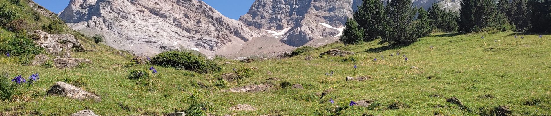
Trail Walking of 13 km to be discovered at Occitania, Hautespyrenees, Gavarnie-Gèdre. This trail is proposed by sereton.
Description
Du village au Cirque
Photos


Positioning
Country:
France
Region :
Occitania
Department/Province :
Hautespyrenees
Municipality :
Gavarnie-Gèdre
Location:
Gavarnie
Start:(Dec)
Start:(UTM)
744610 ; 4735900 (30T) N.
Comments