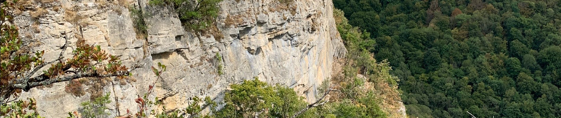
Arbois - Les planches - Rocher du feu - Arbois

Silke Roth
User
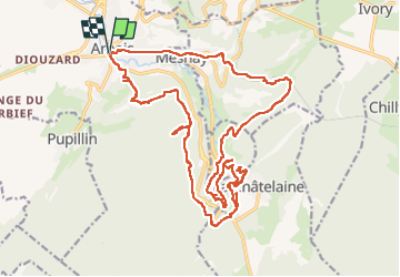

Length
27 km

Max alt
582 m

Uphill gradient
883 m
Km-Effort
38 km

Min alt
290 m

Downhill gradient
883 m
Boucle
Yes
Creation date :
2022-08-13 14:37:36.0
Updated on :
2022-08-14 15:26:39.551
8h42
Difficulty : Difficult

FREE GPS app for hiking
 SityTrail
IGN / Geographical institutes
SityTrail Plus
The world is yours!
About
Trail Walking of 27 km to be discovered at Bourgogne-Franche-Comté, Jura, Arbois. This trail is proposed by Silke Roth.
Photos


Positioning
Country:
France
Region :
Bourgogne-Franche-Comté
Department/Province :
Jura
Municipality :
Arbois
Location:
Unknown
Start:(Dec)
Start:(UTM)
711115 ; 5198001 (31T) N.
Comments