


Annecy 15-08-22

MAUVAGE Patrick
User

Length
3.5 km

Max alt
461 m

Uphill gradient
32 m
Km-Effort
3.9 km

Min alt
446 m

Downhill gradient
31 m
Boucle
Yes
Creation date :
2022-08-15 16:26:36.0
Updated on :
2022-08-15 19:25:02.661
1h56
Difficulty : Easy

FREE GPS app for hiking
 SityTrail
IGN / Geographical institutes
SityTrail Plus
The world is yours!
About
Trail Walking of 3.5 km to be discovered at Auvergne-Rhône-Alpes, Upper Savoy, Annecy. This trail is proposed by MAUVAGE Patrick.
Photos


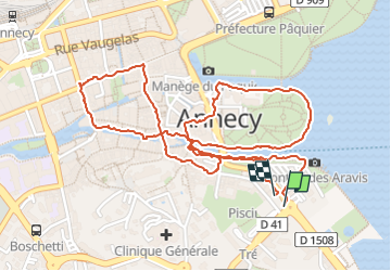
Positioning
Country:
France
Region :
Auvergne-Rhône-Alpes
Department/Province :
Upper Savoy
Municipality :
Annecy
Location:
Annecy
Start:(Dec)
Start:(UTM)
277471 ; 5086582 (32T) N.
Comments