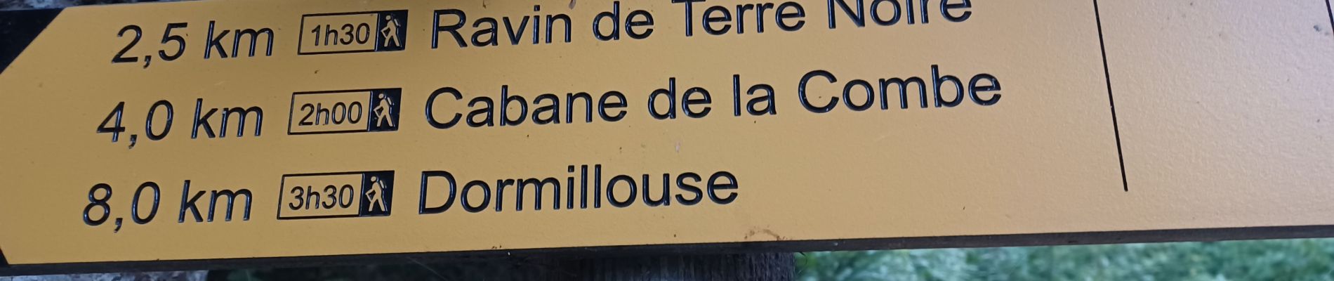
SAINT JEAN MONTCLAR , forêt de Galisson , cabane de la Combe , o l m s

RobinMicheline
User GUIDE
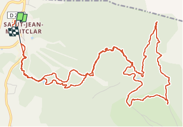

Length
10.6 km

Max alt
1977 m

Uphill gradient
655 m
Km-Effort
19.4 km

Min alt
1324 m

Downhill gradient
660 m
Boucle
No
Creation date :
2022-08-16 04:42:40.122
Updated on :
2022-08-20 12:36:55.26
3h09
Difficulty : Difficult

FREE GPS app for hiking
 SityTrail
IGN / Geographical institutes
SityTrail Plus
The world is yours!
About
Trail Walking of 10.6 km to be discovered at Provence-Alpes-Côte d'Azur, Alpes-de-Haute-Provence, Montclar. This trail is proposed by RobinMicheline.
Description
Bien indiquer , bien ombrager , sympa
Photos


Positioning
Country:
France
Region :
Provence-Alpes-Côte d'Azur
Department/Province :
Alpes-de-Haute-Provence
Municipality :
Montclar
Location:
Unknown
Start:(Dec)
Start:(UTM)
288986 ; 4921015 (32T) N.
Comments