


Montbrun Corronsac fait 2022

pidjam
User
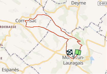

Length
8.3 km

Max alt
283 m

Uphill gradient
183 m
Km-Effort
10.7 km

Min alt
199 m

Downhill gradient
183 m
Boucle
Yes
Creation date :
2022-08-18 06:43:16.022
Updated on :
2022-08-18 09:10:37.302
2h27
Difficulty : Medium

FREE GPS app for hiking
 SityTrail
IGN / Geographical institutes
SityTrail Plus
The world is yours!
About
Trail Walking of 8.3 km to be discovered at Occitania, Haute-Garonne, Montbrun-Lauragais. This trail is proposed by pidjam.
Positioning
Country:
France
Region :
Occitania
Department/Province :
Haute-Garonne
Municipality :
Montbrun-Lauragais
Location:
Unknown
Start:(Dec)
Start:(UTM)
380507 ; 4812654 (31T) N.
Comments