


Randonnée Pyrénées jour 5

cbenoit38
User

Length
10.3 km

Max alt
2613 m

Uphill gradient
1249 m
Km-Effort
23 km

Min alt
1405 m

Downhill gradient
140 m
Boucle
No
Creation date :
2022-08-18 06:30:20.0
Updated on :
2022-08-19 11:50:12.426
5h17
Difficulty : Very difficult

FREE GPS app for hiking
 SityTrail
IGN / Geographical institutes
SityTrail Plus
The world is yours!
About
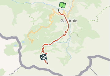
Trail Walking of 10.3 km to be discovered at Occitania, Hautespyrenees, Gavarnie-Gèdre. This trail is proposed by cbenoit38.
Photos


Positioning
Country:
France
Region :
Occitania
Department/Province :
Hautespyrenees
Municipality :
Gavarnie-Gèdre
Location:
Gavarnie
Start:(Dec)
Start:(UTM)
743808 ; 4736180 (30T) N.
Comments