


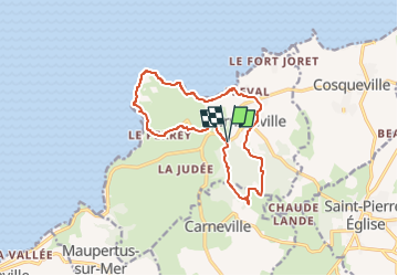
Fermanville- Le cap Lévi

JMCMoreau
User

Length
12.5 km

Max alt
83 m

Uphill gradient
174 m
Km-Effort
14.8 km

Min alt
-1 m

Downhill gradient
174 m
Boucle
Yes
Creation date :
2022-08-19 16:42:51.443
Updated on :
2022-08-19 16:44:06.928
3h30
Difficulty : Medium

FREE GPS app for hiking
 SityTrail
IGN / Geographical institutes
SityTrail Plus
The world is yours!
About
Trail Walking of 12.5 km to be discovered at Normandy, Manche, Fermanville. This trail is proposed by JMCMoreau.
Positioning
Country:
France
Region :
Normandy
Department/Province :
Manche
Municipality :
Fermanville
Location:
Unknown
Start:(Dec)
Start:(UTM)
612001 ; 5504526 (30U) N.
Comments