


Essoyes_2022-8-20_real

DomifaC
User

Length
23 km

Max alt
334 m

Uphill gradient
393 m
Km-Effort
28 km

Min alt
179 m

Downhill gradient
393 m
Boucle
Yes
Creation date :
2022-08-20 06:40:34.102
Updated on :
2022-08-20 16:29:35.554
6h07
Difficulty : Very easy

FREE GPS app for hiking
 SityTrail
IGN / Geographical institutes
SityTrail Plus
The world is yours!
About
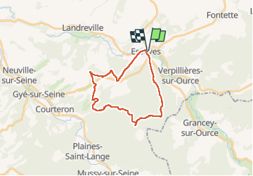
Trail Nordic walking of 23 km to be discovered at Grand Est, Aube, Essoyes. This trail is proposed by DomifaC.
Positioning
Country:
France
Region :
Grand Est
Department/Province :
Aube
Municipality :
Essoyes
Location:
Unknown
Start:(Dec)
Start:(UTM)
614575 ; 5323853 (31U) N.
Comments