


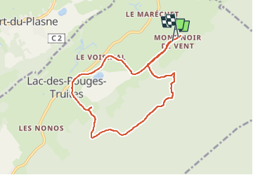
Mont Noir de Vent

cmike39
User

Length
8.1 km

Max alt
1106 m

Uphill gradient
225 m
Km-Effort
11.1 km

Min alt
917 m

Downhill gradient
225 m
Boucle
Yes
Creation date :
2022-08-21 11:56:22.257
Updated on :
2022-08-21 14:01:33.942
2h03
Difficulty : Medium

FREE GPS app for hiking
 SityTrail
IGN / Geographical institutes
SityTrail Plus
The world is yours!
About
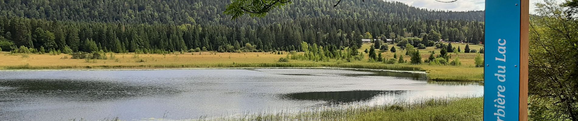
Trail Walking of 8.1 km to be discovered at Bourgogne-Franche-Comté, Jura, Lac-des-Rouges-Truites. This trail is proposed by cmike39.
Photos


Positioning
Country:
France
Region :
Bourgogne-Franche-Comté
Department/Province :
Jura
Municipality :
Lac-des-Rouges-Truites
Location:
Unknown
Start:(Dec)
Start:(UTM)
272156 ; 5166670 (32T) N.
Comments
