


Atali

Vinceneux
User
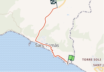

Length
4.6 km

Max alt
99 m

Uphill gradient
116 m
Km-Effort
5.8 km

Min alt
2 m

Downhill gradient
23 m
Boucle
No
Creation date :
2022-08-22 16:10:13.251
Updated on :
2022-08-22 16:48:11.68
37m
Difficulty : Easy

FREE GPS app for hiking
 SityTrail
IGN / Geographical institutes
SityTrail Plus
The world is yours!
About
Trail Walking of 4.6 km to be discovered at Balearic Islands, Unknown, es Migjorn Gran. This trail is proposed by Vinceneux.
Positioning
Country:
Spain
Region :
Balearic Islands
Department/Province :
Unknown
Municipality :
es Migjorn Gran
Location:
Unknown
Start:(Dec)
Start:(UTM)
589992 ; 4417955 (31S) N.
Comments