


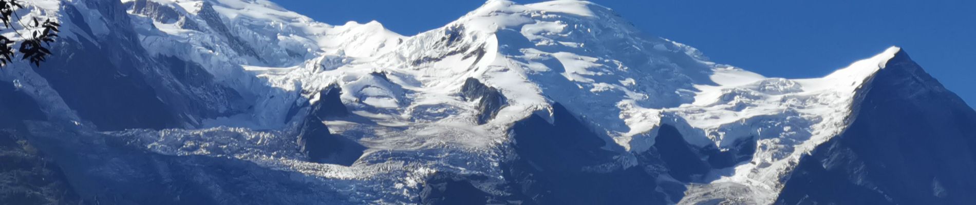
CHAMONIX ... le chalet de la Floria.

GerardBouche
User


2h14
Difficulty : Medium

FREE GPS app for hiking
 SityTrail
IGN / Geographical institutes
SityTrail Plus
The world is yours!
About
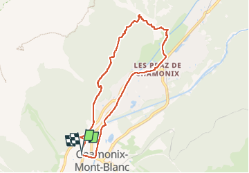
Trail Walking of 8 km to be discovered at Auvergne-Rhône-Alpes, Upper Savoy, Chamonix-Mont-Blanc. This trail is proposed by GerardBouche.
Description
Très beau parcours boisé vers le chalet-buvette de la Floria pour son point de vue sur les Aiguilles de Chamonix. Une pause s'impose pour une boisson rafraîchissante ou une petite restauration montagnarde. La descente par un petit sentier ombragé avant de retrouver le '' Paradis des Praz ".
Photos


Positioning
Comments
Très beau parcours, merci. Le repas au chalet se mérite ! 😉