


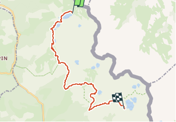
Refuge de Vens -- Refuge du Rabuons par le Lac Fer

donda
User GUIDE

Length
14.4 km

Max alt
2560 m

Uphill gradient
873 m
Km-Effort
26 km

Min alt
2288 m

Downhill gradient
724 m
Boucle
No
Creation date :
2022-08-23 05:54:46.344
Updated on :
2022-08-27 12:34:05.771
4h52
Difficulty : Very difficult

FREE GPS app for hiking
 SityTrail
IGN / Geographical institutes
SityTrail Plus
The world is yours!
About
Trail Walking of 14.4 km to be discovered at Provence-Alpes-Côte d'Azur, Maritime Alps, Saint-Étienne-de-Tinée. This trail is proposed by donda.
Description
2ème Jour Chemin de l'Energie
Photos


Positioning
Country:
France
Region :
Provence-Alpes-Côte d'Azur
Department/Province :
Maritime Alps
Municipality :
Saint-Étienne-de-Tinée
Location:
Unknown
Start:(Dec)
Start:(UTM)
335878 ; 4909100 (32T) N.
Comments